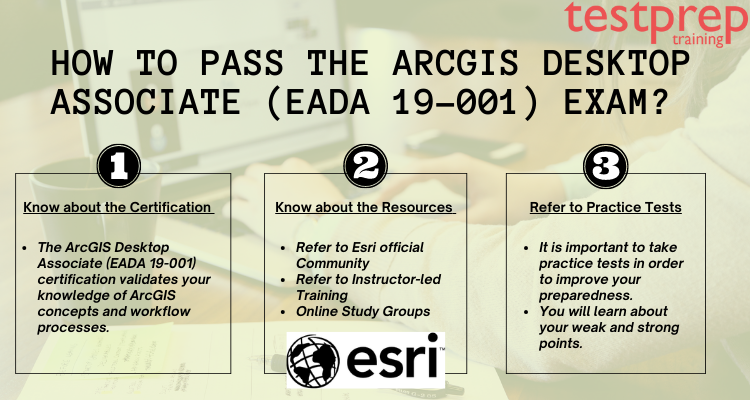
The ArcGIS Desktop Associate (EADA 19-001) certification validates your knowledge of ArcGIS concepts and workflow processes. Individuals with at least two years of practical experience working on the ArcGIS platform are eligible for this certification. This certification exam will test your knowledge and assist you in developing expertise in visualizing, managing, and analyzing geospatial data on the ArcGIS platform.
Let us look at the ArcGIS Desktop Associate (EADA 19-001) Exam Preparation Guide!
About the ArcGIS Desktop Associate (EADA 19-001) Exam
The ArcGIS Desktop Associate exam assesses the candidate’s knowledge of ArcGIS concepts and processes as they apply to workflows. Candidates should be able to demonstrate their ability to visualize, manage, and analyze geospatial data using ArcGIS. Qualified candidates should have two or more years of practical experience and be knowledgeable about best practices and the use of Esri’s ArcGIS technologies.
Who should take the exam?
The ArcGIS Desktop Associate exam assesses a candidate’s understanding of ArcGIS concepts, including knowledge of the ArcGIS Platform. It is preferred that the candidate have two or more years of practical experience with ArcGIS. Candidates must be able to apply principles of content sharing, analysis, data management, editing 2D and 3D features, mapping, and visualization across the ArcGIS Platform. Passing the exam allows candidates to demonstrate their technical expertise in implementing ArcGIS Desktop best practices.
Candidates seeking to take the ArcGIS Desktop Associate (EADA 19-001) certification exam should be familiar with the following tools:
- Firstly, ArcGIS Pro
- Secondly, ArcGIS Online
- Thirdly, ArcGIS Enterprise
- Also, ArcGIS Apps for the Field
Let us now jump on to the main objective of this article!
How to prepare for the ArcGIS Desktop Associate (EADA 19-001) Exam?
The real challenge is preparing for an exam. The two most important keys to unlocking your certification are consistency and determination. However, it is also critical to prepare using legitimate resources and to stay on track. Let us look at the comprehensive step by step guide through which you can pass the exam with flying colors –

Step 1 – Know about the Exam Syllabus
These are the main modules of the exam –
Data Management [35%]
- Comparison and contrast between various types of vector and raster datasets supported in ArcGIS
- Application of appropriate coordinate systems to preserve the desired spatial properties
- Determining how to migrate data to a file geodatabase, feature class, or table.
- Application of spatial and attribute data validation.
- Determining the use of the ArcGIS Platform components and geodatabase types in managing data.
- Determining appropriate existing geodatabase elements to use
- Managing raster, tabular, and vector data.
- Managing metadata and item details
Data Manipulation [17%]
- Using the ArcGIS platform’s editing functionality in creating, modifying, and deleting 2D and 3D data.
- Resolving the root cause of data alignment problems
- Application of SQL query.
- Determining how to repair the link between a layer and its data source
- Troubleshooting data anomalies with tabular and vector data
Visualization [14%]
- Identifying how to control coordinate system and geographic transformation in ArcGIS Desktop
- Managing layer properties
- Determining how to visualize temporal, ranged, or 3D data
Sharing [14%]
- Identifying how to export data, maps, and scenes to different formats
- Moreover, Choosing how to share content across the ArcGIS Platform
- Identifying the purpose of metadata, item description, and other properties for sharing
- Determining how to create and manage map layouts and map books
Analysis and Geoprocessing [20%]
- Comparing the functionality of table joins and relates, relationship classes, and spatial joins
- Also, Determining the appropriate geoprocessing tool to use
- Using tasks, batch processing, models, or scripts to execute a complex workflow
- Identifying analysis tools available from the connected portal
- Applying raster functions for raster processing
Step 2 – Know about the exam Format
These are the major details that you must know before sitting for the exam –
- Exam Name ArcGIS Desktop Associate
- Also, Exam Code EADA 19-001
- Exam Duration 2 hours
- Moreover, Exam Format Multiple Choice
- Exam Type Core
- Number of Questions 79 Questions
- Furthermore, Eligibility/Pre-Requisite Mentioned above
- Exam Fee $250 USD
- Moreover, Exam Language English
- Pass Score a score report illustrating a section level analysis of your performance
Step 3 – Know about the Exam Policies
Some of the important policies that you need to know are –
Exam Result
After taking the ArcGIS Desktop Associate (EADA 19-001) exam on the scheduled date, you will receive your exam results within 5 to 10 days. You should be aware that the outcome will not include the numerical scores you received on the exam. The result will be a score report that depicts a section-level analysis of your performance. However, such section-level analysis score reports are not available for specialty exams. In that case, you will only be notified of your performance.
Exam Retake Policy
Candidates can only take the live exam version three times. Moreover, there is no additional retake fee to pay. Core exams, including retakes, cost USD 250, while speciality exams, including retakes, cost USD 150. Candidates must wait at least fourteen (14) days after the scheduled exam date to be eligible for a second attempt. If the candidate fails the second time, he must wait ninety (90) days before taking the exam a third time.
Step 4: Make a Strategic Plan
The next step is to devise a study strategy for your preparations. Keep the course topics and the time remaining for the real exam in mind as you plan. Remember to start by concentrating on your weaker areas. In addition, pay close attention to exam topics with a higher weightage. Following your plan will help you stay consistent and avoid distractions. The key to success is to start early, so get started and stay motivated.
Step 5 – Refer to Official resources
The training resources listed below are available to help you prepare for your exam but are not required. Please use the list of preparation resources in conjunction with the list of “skills measured” topics to identify suitable training options for any potential knowledge gaps. Moreover, This exam’s Esri-curated Learning Plan is constantly updated based on the Training Services course and content retirement schedule.
Introduction to GIS Using ArcGIS –
Introduction to Geographic Information Systems Using the ArcGIS training program will teach you the fundamental concepts that underpin GIS technology and geographic data. Candidates will gain experience using GIS maps to visualize and explore real-world features as a result of this training. You will also learn how to analyze data to answer questions and create new information, as well as how to share maps, data, and other resources with others in your organization.
Migrating from ArcMap to ArcGIS Pro –
Migrating from ArcMap to ArcGIS Pro training includes using faster tools and integrated 2D and 3D capabilities to streamline your GIS projects with ArcGIS Pro. This course will teach you how to become an expert ArcMap user. You will master the essential ArcGIS Pro terminology and concepts. Furthermore, you’ll be able to complete a variety of tasks related to mapping, editing, analyzing, and sharing geospatial data and resources with ease.
Step 6 – Refer to other resources
Books – The Esri Academy offers reference books that can be useful when preparing for the exam. These books contain a variety of useful resources for gaining a deeper understanding of the exam objectives and, as a result, passing the test and earning your certification. Eris Academy recommends two important books for the exam:
- The ArcGIS Book: 10 Big Ideas about Applying The Science of Where
- Getting to Know ArcGIS Pro, second edition
Online Forums – A healthy debate is always beneficial, regardless of where it takes place. The same is true for online discussion boards. This is a good opportunity for students to discuss their concerns and gain insight into how their competitors are preparing for the exams. One advantage of anything that goes online is the number of people who can join it. An offline discussion is limited to a small group of people, whereas online platforms can reach a much larger audience.
Practice tests – Mistakes are unavoidable, but they can be minimized. When it comes to exams, practice papers are extremely helpful in limiting mistakes. Because errors in practice papers are easily avoided in the exam. It is critical to train the brain. ESRI Desktop Associate 19-001 practice exam tests provide the simulation that the brain requires to become accustomed to the actual exam. Aside from knowledge, numerous factors can influence your exam performance. Now is the time to take a free practice test!
Step 7 – Expert Advice
The more correct answers you get on a practice paper, the more confident you’ll feel about the exam. You will also be aware of how much time and effort is required for each section of the question paper. Your brain will be trained to perform at its peak for the duration of the exam. All of these variables can have a significant impact. Remember that your grade is based on how much you wrote, not how much you know. Only when talent translates well in performance can it be judged. Begin practicing right away!
Summary
The ArcGIS Desktop Associate exam assesses candidates’ knowledge of ArcGIS concepts and processes as they apply to workflows. Candidates should have comprehensive knowledge of working with the ArcGIS platform. Furthermore, Candidates should be able to visualize, manage, and analyze geospatial data using ArcGIS. This exam will test you on different aspects but with the right approach, you can ace the exam in one go!


